A vision of Ireland through time
A vision of Ireland from 1821 onwards.
Including maps, statistical trends and historical descriptions.
A vision of Ireland through time
A vision of Ireland from 1821 onwards.
Including maps, statistical trends and historical descriptions.
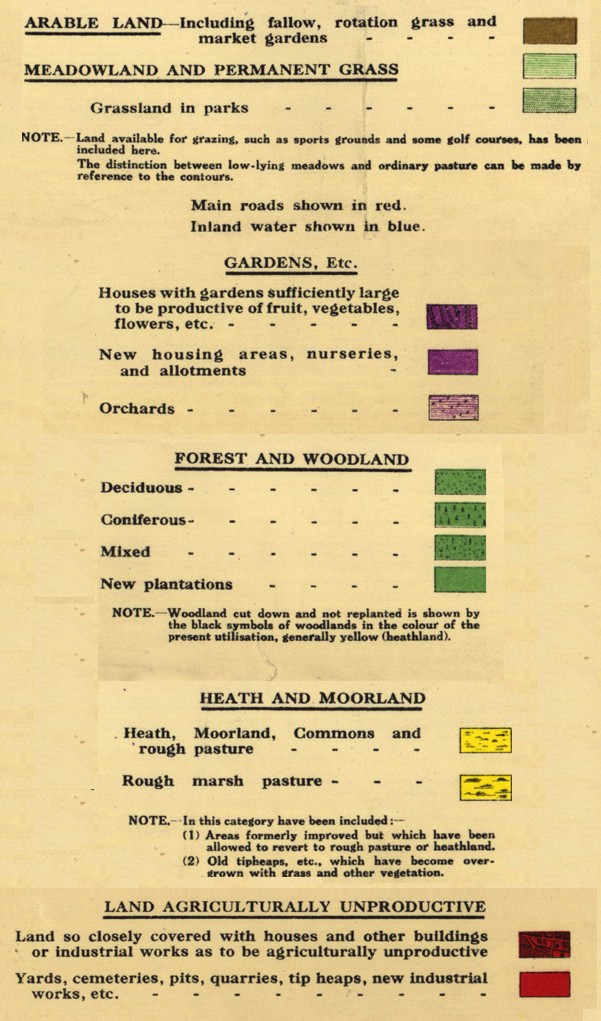
The most unusual part of our historic mapping comes from the Land Utilisation Survey of Great Britain, compiled during the 1930s by schoolchildren throughout the country under the direction of Professor Sir L. Dudley Stamp and his team based at the London School of Economics. They published the maps themselves using the Ordnance Survey One-Inch Popular Edition as a base, and we are deeply grateful to the copyight holder for permission to include them, to the many map librarians who provided copies for scanning, and to the Environment Agency and the Department of the Environment, Farming and Rural Affairs who funded work on the published maps. We include Stamp's ten mile to the inch summary sheet to provide an overview of the country.
As well as all the maps Stamp published, we also include the 56 maps covering upland Scotland, hand painted in water colour to show land use, that Stamp deposited with the Royal Geographical Society (RGS Control No. 568206). We are very proud that the whole of Stamp's survey has finally been published, through our site. We thank the RGS, the Frederick Soddy Trust who funded this work, and the Imperial Mapping Company who scanned the maps for us at no charge.
Here is a key to the LUS maps. N.B. Stamp's project used nine different printers, so a fair amount of variation in the colours even in the printed maps is inevitable: